Posts

Showing posts from August, 2019

Thursday, August 29th-An Early Stop in Juneau

Image
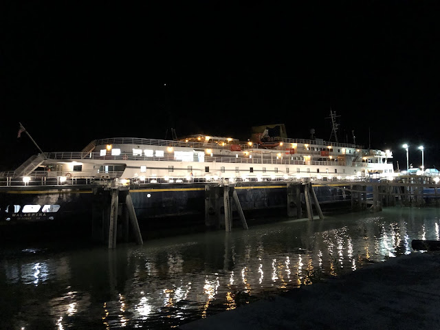
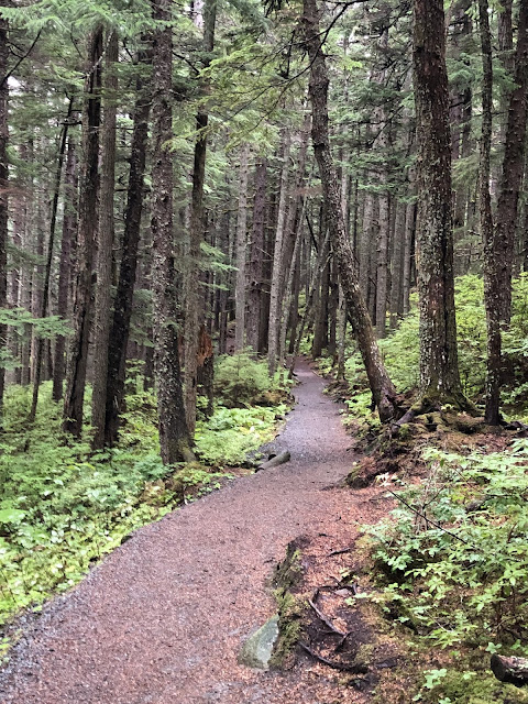
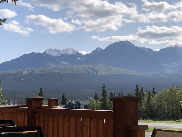
We got on the ferry about 10:00 PM yesterday and the ferry got to Juneau about 5:00 AM today. The “Mal” is 408 feet long with 3 accessible levels. We have an outside cabin so we can sit inside if we’d like and watch Alaska go by. Here a pic of the Malaspina I took last night at the dock in Haines: The only bad thing about the ferry is that pets aren’t allowed on any of the decks except the Car Deck where the truck and camper are parked. Passengers are only allowed on the Car Deck when the ship is in port or the Purser makes a “Car Deck Call.” Sooooo, I set the alarm and got up at 6:00 AM to take her out. I’ll bet you can’t find Kake, Alaska on a map without looking! It’s another one of those tiny towns that can’t be accessed by roads. The Alaska Marine Highway System stops mainly at cities with no highway access. Today? Just going South on the Inside Passage through magnificent scenery! We have probably seen 2-3 DOZEN whales this afternoon alone. We saw one jump completely out of

Wednesday, August 28th-We’re Going to Miss Haines

Image
I walked out of the camper this morning and these were the views I had: We’ve had a few nice campgrounds on this trip but NONE of them can match the oceanfront location here! Just for grins, here’s a pic of using having lunch today: Life is tough, isn’t it? Tonight we’re gettin on a ferry to return to British Columbia, Canada so we’ll basically be inaccessible for the next two days. We may have some cell coverage at the 4-5 stops so I’ll try to post something then if I can find some coverage. Our last remaining drive in Alaska will be from the campground to the ferry terminal here in Haines. The ferry stops in Juneau, Kake, Petersburg, Wrangell, and Ketchikan on the way to Prince Rupert, BC. I checked a map and none of those cities have ANY highway access! Can you imagine a state capital like Juneau that can be reached only by boat or airplane? One thing I haven’t written about Alaska is the expense of things. Alaska is more expensive than any of the 49 states I’ve been t

Tuesday, August 27th-Chilkat State Park Near Haines

Image
It was very nice to talk with Carol McKenzie and Lisa Hall this morning! I sure miss all those wonderful co-workers at LSC-Kingwood! Today we drove about 10 miles from Haines to this state park. Here are three things we saw on the way there: This is Mud Flat Road going from Haines to the state park. Beautiful huh? In the lower 48, this would be a national scenic byway or something like that. Here it’s just Mud Flat Road! I guess you make whatever materials you need for furniture. These were drying in the sun on the side of the road! We’ve seen a lot of 6% grade roads, a few 8% grades, and 1-2 10% grade roads but 14%? The hiking today was an almost two-hour jaunt into a temperate rain forest. Here is a pic of part of the trail: We didn’t hike the entire seven miles (one way!) of the trail. We went as far as Moose Meadow and these are some of the views we had:

Monday, August 26th-Welcome to the Fall-2019 Semester! (OOPS!)

Image
I’ve been writing this blog title for the past 20 years so it’s a habit that hard to break! The only work I did today, as my first semester as an adjunct, was to check my school email and sent my syllabus to Terri. The rest of today, Diana and I explored more of Haines. The first place we went was the the Alaska Marine Highway System ferry terminal here in Haines. A camper two units down from us was taking the ferry up to Skagway and we wanted to watch it get ready to leave. We’ll be on a different ferry headed South on Wednesday. The ferry they took was the Columbia. Here’s a pic of the Columbia at the ferry terminal port: Next we walked to Fort Seward which was an Army base right here in Haines that was started in 1903.  It was built to 1) bring some order to the gold rush days and 2) to establish a military presence when the US and Canada had a border dispute. Here’s a pic of Diana by one of the magnificent hanging baskets on the Fort Seward dock: Fort Seward was decommis

Saturday, August 24th-H2 (Hiking in Haines!)

Image
Diana woke up this morning and decided it was time for a good breakfast so it was! How about hash browns, biscuits with gravy, scrambled eggs, and sausage. No, it wasn’t reindeer sausage! But it was a very good breakfast! BTW, Diana does almost all the cookin’ And I do almost all the cleanin’! We found a nice 2.4 mile hike called the Battery Point Trail. It was a little long for us today so we went as far as Kelgaya Point which shortened the hike to 1.2 miles each way. Here are two pictures of the trail. What do you think of a trail like this through an old growth rainforest? We were having a great time hiking along listening to the nothingness of the forest when we met a woman walking with her dog. He is a 156 pound Great Malamute names Gooch. Here’s a pic of Diana with Gooch and this IS a really big dog: Yesterday we saw a bear catch a Salmon in a river. Today we saw a Bald Eagle flying with a Salmon in his claws. Diana got this pic but the Eagle was too far away and

Friday, August 23rd-Haines, AK

Image
Most of today has been spent in the public library glomming on the free wi-fi! I’m still going to teach one online class each semester and most of today was spent getting ready for this Fall semester. We walked to the library in Haines and decided that it’s a cute little town! Here’s a pic from our campground here: The name of this campground is Oceanfront RV Park and it sure is! We can walk across the parking lot to the water of the Chilkat Inlet. Here’s another pic from Main Street Haines down to the water: Haines isn’t nearly as “touristy” as Homer or Seward but the mountains around the inlet are just as beautiful. We haven’t spent a lot of time “splorin’ Haines yet but we have four full days until the ferry leaves. Late this afternoon we drove to Chilkoot Lake to look for bears and bald eagles. We didn’t see ANY on the way or while we were at the lake. However, we hit paydirt on the way back! We saw this bald eagle sitting majestically on top of a tree AND this bear catch

Thursday, August 22nd-More Random Beauty

Image
Last night we had dinner at a little place called Frosty’s in Haines Junction, YT. I’ve posted a lot of places where we have our picnic lunch so here’s a pic of the view from the deck of Frosty’s: Today we left the Yukon Territory, drove through a corner of British Columbia and got to our last Alaskan city on this trip-Haines! We didn’t see any moose, caribou, or bears but we do have a bald eagle perched on a pier in front of our campground. It’s misting rain so we couldn’t get a good picture of it but here’s the best we could do: There is a Bald Eagle preserve just North of here and we may go there one day next week. Haines is famous for being the Bald Eagle capital of the US so we’ll test that then. We stopped at a couple of places with jaw-dropping views today. Notice that this place doesn’t have a sign or anything. It’s just a run-is-the-mill turnout looking into Canada’s Kluane National Park: You can’t get bored with the beauty of nature in Alaska, the Yukon, or BC!

Wednesday, August 21st-Just Routine Beauty!

Image
I don’t have a lot of pics to share with you today-just one. We were driving through the Yukon and we stopped at a rest area. We took care of business and took a look around. What did we see? Just this view: The tops of the mountains have snow on them now, which they didn’t have when we drove through here in June. It’s very obvious that Autumn is in the air. We’ve had two mornings in a row where it’s 38 degrees F when we wake up in the mornings. And that’s after the 34 degree morning earlier this week!

Tuesday, August 20th-Back in The U S.....(OOPS Yukon Territory!)

Image
No, we’re not back in the USA but we’re not in Alaska either. We drove from Glennallen, AK to Beaver Creek, YT. We’ll be back in Canada for two days before going back to Alaska. HUH? You have to look at a map of Alaska, Yukon, and BC to understand the geography and the roads up here! Tomorrow we stay in Yukon all day but leave Yukon for BC on Thursday. Then we reenter Alaska later that day for Haines, AK. Sound confusing? Yes, it’s hard to keep up with Canadian vs US dollars, liters of fuel vs gallons, and kilometers per hour speed limits vs MPH speed limits! Here’s a pic of my Bride of 48 years with Soo Young when we reentered the Yukon Territory: We also saw eight-count ‘em-EIGHT moose between Glennallen and Beaver Creek today. They are large majestic animals!

Monday, August 19th-Guess Where?

Image
Yes, we drove down to Valdez for the day! A LOT of things about today were different. I’ll try to list them all: It was 34 degrees here when we woke up this morning but the high was 59 We saw a large moose cow standing on the shoulder Even with two dumpsters, the view of the mountains at lunch was beautiful The security around Valdez Harbor is VERY tight. This has to do with Valdez being the Southern terminus of the Alaska Pipeline. Remember the Exxon Valdez? Here’s a pic of the security measures around the harbor and port. You will have to enlarge the map of the three zones but you’ll get it when you look closely at the map. By the way, Valdez was chosen as the Southern end and storage/loading facility because it’s the Southernmost ice-free port in Alaska. I’ve mentioned the 9.2 Great Alaska Earthquake in 1964. Well, Valdez was another one of those entire cities that has to be moved to a new location as a result of the earthquake! Here are the icebergs in the

Saturday, August 17th-Wrangell-St Elias NP

Image
This was a looooong day! We were a little slow getting up and going because the temperatures have already started to drop! When I say DROP, I don’t mean into the 70’s! It was 41 degrees when I woke up this morning! The forecasts are for low temps tonight and tomorrow to be around freezing.......and this is just August! I do NOT want to be in Alaska during the winter. We drove into Wrangell-St Elias and viewed more high mountains than I’ve ever seen. This park is a lot like Denali NP in that a lot of emphasis is put on the “Preserve” part of the park name. Denali has ONE road that leads into its 6.2 million acres. W-SE has two roads into its 13+ million acres. The entire point of both of these parks is that we humans are to change as few parts of these parks as possible. We took the longer of the two roads into the park and it has quite a history: McCarthy was a small trading post on the Copper River at the turn of the last century. No roads-just river travel. Around 1910, copper is f

Friday, August 16th-Wrangell-St Elias National Park

Image
Today we went to the Visitor Center and went hiking near the entrance to the park. Here’s my Bride of 48 years at the entrance: Wrangell-St Elias has on its website (https://www.nps.gov/wrst/whats-so-special.htm) a list they call Park Superlatives. Here’s the list with my one addition at the end: Largest national park in the United States (At 13.2 million acres or over 20,000 square miles, it’s the same size as Yellowstone NP, Yosemite NP, and Switzerland COMBINED!) Largest wilderness area in the National Wilderness Preservation System Designated a World Heritage Site with Glacier Bay National Park and Preserve with Canadian neighbors Kluane National Park Reserve and Tashenshini-Alsek National Park (Making this the world’s largest international wilderness.) Four major mountain ranges-Wrangell, St Elias, Chugach, and the Eastern part of the Alaska Range Mt St Elias, at 18,008 feet, is the second highest peak in the United States Nine of the 16 highest peaks in the United Stat

Thursday, August 15th-From Palmer to Glennallen, AK

Image
Today we left our campground in Palmer and drove the Glenn Highway to Glennallen. We have been amazed by the beautiful flowers and hanging baskets all over Alaska. Here’s a pic of the front of the office and home of the campground owners in Palmer: We finally asked a native Alaskan about the size and beauty of these hanging baskets and the other fruits and vegetables that are abnormally sized. The answer we got was perfectly logical: the sun shines 16 to 21 hours a day during the growing season and the high temps rarely get above 80 degrees. I’ll buy that! BTW, the campground is Palmer is the Mt View RV Park-can’t imagine where it got its name: I’ve been posting pics of where we’ve been eating our picnic lunches day so here’s another one for you: It’s easy to see Diana and Soo Young in this pic but did you notice that monster glacier in the background? If this glacier looks familiar to you, it’s because it’s the glacier we hiked to and on 5-6 weeks ago. It’s 27 miles long

Tuesday, August 13th-Seward to Palmer

Image
There isn’t much to say about today except that it was a run-of-the-mill 170 mile drive through magnificent scenery! It seems everywhere you look in Alaska is either beautiful, very tall mountains, fjord carved valleys, or a combination of the two. To make this point, here is a pic FROM our campground the last three nights in Seward: The scenery is awe inspiring even from a rathole of the campground we were in. There was a Salmon Derby going on in Seward and it seems that everyone with a boat was fishing for Salmon! Sooooo all the campgrounds were bursting at the seams. We only stayed at this one because it wasn’t full. Why wasn’t it full when all the other campgrounds were full? Well, let me count the reasons: It is located 1.5 miles off the Seward Highway about four miles North of Seward, It is essentially a large vacant lot covered with gravel,  There are no facilities and I mean NOTHING-no office, rec hall, bathrooms except one portapotty, showers, or hookups except electri

Monday, August 12th-A Spectacular Day on the Water!

Image
Today we took a nine hour day cruise into Kenai Fjords National Park. What did we see? My goodness, it’s hard to list them all! Let’s start with 30-40 glaciers, building sized icebergs, multiple pods of Orca/ Killer Whales, several humpback whales, dozens of sea otters, jumping Silver Salmon, several different types of birds (Cormorant, Tufted and Horned Puffins, Auklet, Terns, one bald eagle, and Murre), Steller Sea Lions, Harbor Seals, AND some of the most beautiful scenery imaginable! Probably the most spectacular thing we saw was unique calving of the Northwestern Glacier. Here a fixed photo but I’d like to describe for you how it happened. Look at the above pic and imagine this happening: (the boat is about a half mile from the “terminus” of the glacier-where it falls or flows into the ocean) A room sized chunk of ice fell from the upper part of the glacier above the giant rocks at the top of the picture 2-300 feet to the lower section of the glacier along with a lot of